NMS-01S-2N
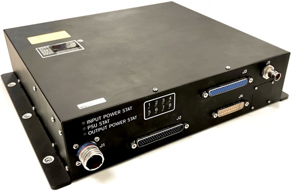
 Air Map System with video transmission device / NMS-01S-2N
This is a map information display device with a video transmission function that can be installed on aircraft and has already obtained Ministry of Land, Infrastructure, Transport, and Tourism equipment specification approval (No. 614-8).
The Air Map System(NMS-01S-2N) is a new product that adds a video streaming function to the conventional Air Map System / aviation information display functions and dynamic management / mission support functions by connecting to an Iridium satellite phone.
| [Features]
- Video streaming function. - Aircraft position display. - Search function. (Address, Latitude/Longitude, aviation-related facilities etc.) - Display Airspace, Power transmission line. - Display Mountain trail and Contour line. - Anti-collision display with other aircraft. - Flight tracking management function. Position information, Messaging, Route, Location, FOCS support, etc. *FOCS=Japanese government-led integrated aircraft operations coordination system. |
[I/O Interface]
- Serial communication interface (RS232C comply) x 6 - Analogue RGB (VGA) x 2 - USB x 4 (with Power supply) - Ethernet x 2 (1ch is for video transmission only) - ARINC429 (RX) x 4 - HD-SDI(input) x 1(video transmission only) - GPIO input x 5 - GPIO output x 2 |
|
|---|---|---|
 |
||
Key Features
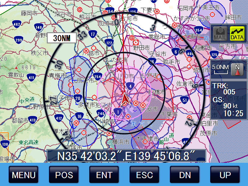
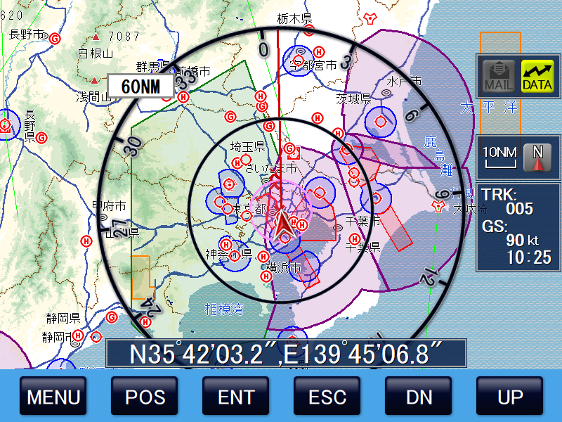
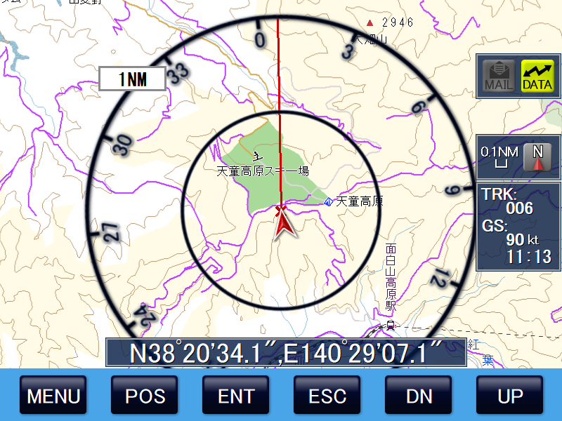
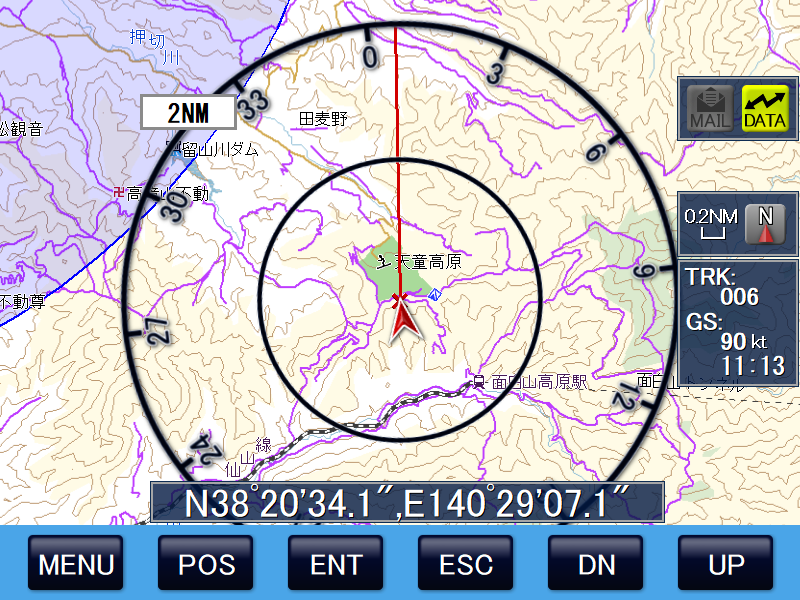
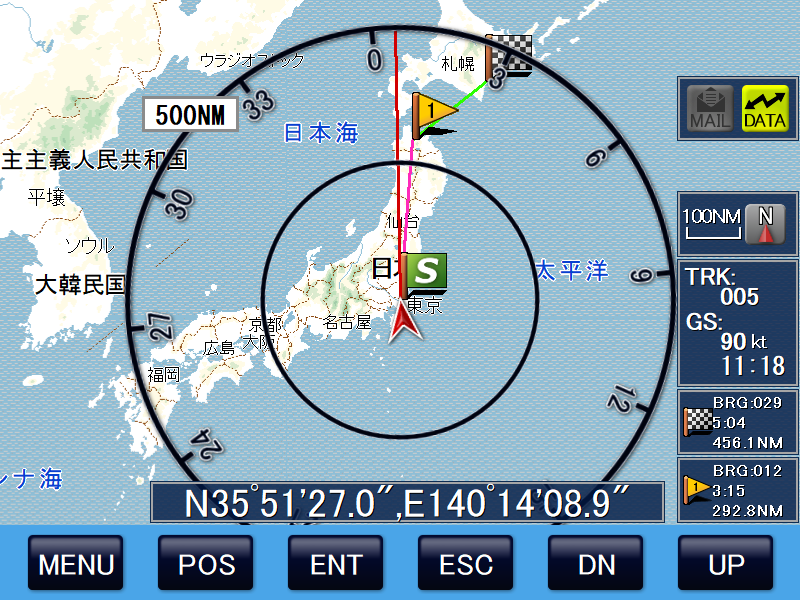
1.Compass circle distance guide
Displays the distance around the compass circle with the player's ship at the center. The inner circle is half the distance of the outer circle. The distance is displayed appropriately based on the map scale.
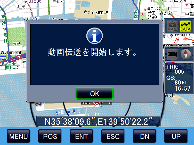
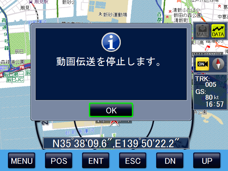
2.Video transmission function
The NMS-01S-2N is equipped with a video transmission function and can be used when combined with the SDL-350™.
3.Contour display function
In mountain rescue, understanding the location of the rescue site is very important information to ensure the safety of the rescue team members descending from the helicopter and to safely recover the person in need of rescue. By displaying contour lines every 50m above sea level, the slope of the site can be understood.
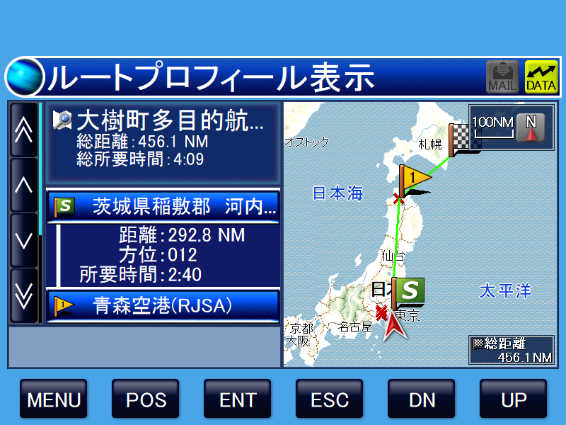
4.Route Function
Flight route registration can be used to register not only the starting point and the destination point, but also multiple WPs along the way, and can be used as advisories during flight. In addition, if dynamic management is being performed, flight route information can be sent from the ground to the aircraft.
Specifications
| Item | Specification |
|---|---|
| Product Name | Air Map System with video transmission device |
| Model Name | NMS-01S-2N |
| Functions | - Map display and flight tracking, etc.
- Video streaming function is available with Iridium Certus SDL-350 device. Codec HEVC-ULC Bit Rate 300/200/100 kbps Resolution 640x360: 5/15fps, 1280x720: 5fps |
| Components | Main unit only |
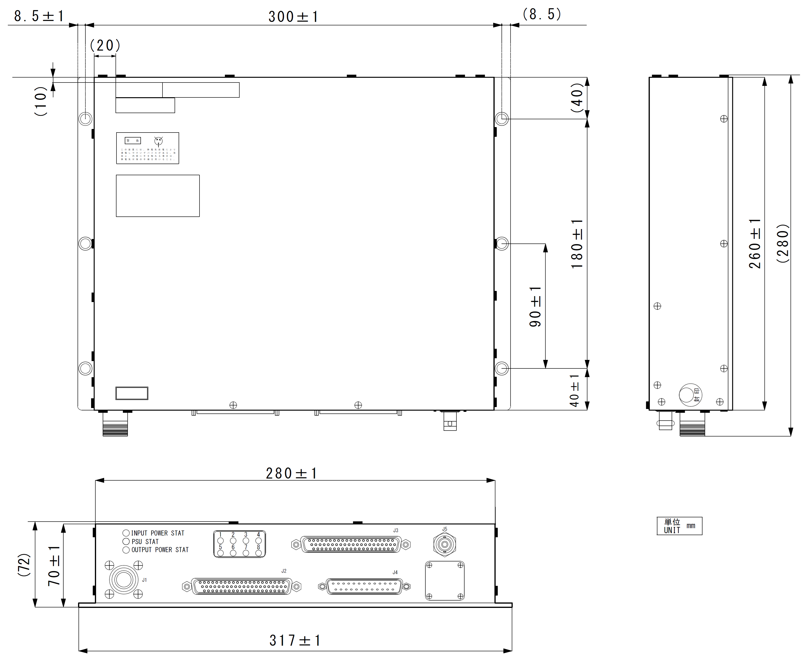
| Dimensions | 280mm × 260mm × 70mm (excluding protrusions) |
| Weight | 3.5kg or less |
| PowerSupply / Consumption | DC28V 70W or less (at normal operation) / 95W or less (when Charging) |
| Temperature range | perating temperature: -15℃ to +55℃, Preservation temperature: -55℃ to +85℃ |
| Accessories | Connector kit, Instruction manual, Installation manual |
| Others | - Applying Specification approval of civil aviation bureau / MLIT
- RTCA/DO-160F environmental test - RTCA/DO-178B / DAL D - Certificate of conformity with equipment standards issued at time of product shipment - Natural heat dissipation without cooling fan. |
